Fire Modeling

Fires are one of the most significant contributors to air pollution. From accidental industrial fires to wildfires, they release large amounts of particulate matter and hazardous chemicals. Some estimates point to wildfires accounting for close to 10% of the global contribution to fine particulate matter. However, the most significant impact occurs at the regional and local level when the contributions from wildfires are much larger than in a global scale. For example, wildfires in the western U.S. are estimated to contribute near 50% to fine particulate matter, and to episodes when a combination of wildfires and meteorological conditions results in hazardous conditions. Because of their diversity and complexity, modeling fires requires using the right approach and a higher level of sophistication than other phenomena. Calculations involving wildfires is a multi-step process that depends on available data and the target outcome.

Wildfire assessment

Satellite measurements provide the most reliable near real-time data on wildfires. However, these data cannot be used directly and requires specific processing to extract the input to be used by other software or for different purposes. Odycloud is currently developing ML-based algorithms to process these data as an alternative to more classical approaches. The objective of these algorithms are the improvement in filtering out “false” fires and to capture the dynamics of large fires spanning across several days, which enhances the estimates of wildfire characteristics such as area or biomass being consumed by the fire. 

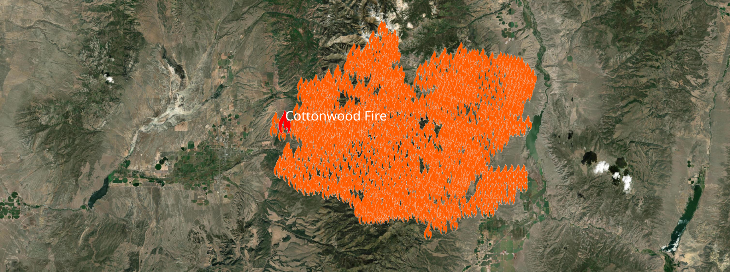
Locations of biomass burned by the Cottonwood Fire in Utah (June, 2026)
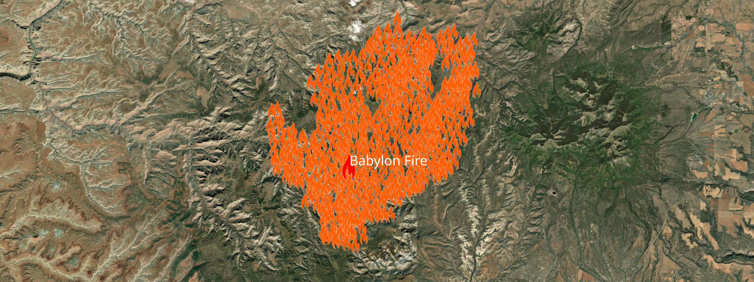
Locations of biomass burned by the Babylon Fire in Utah (June, 2026)
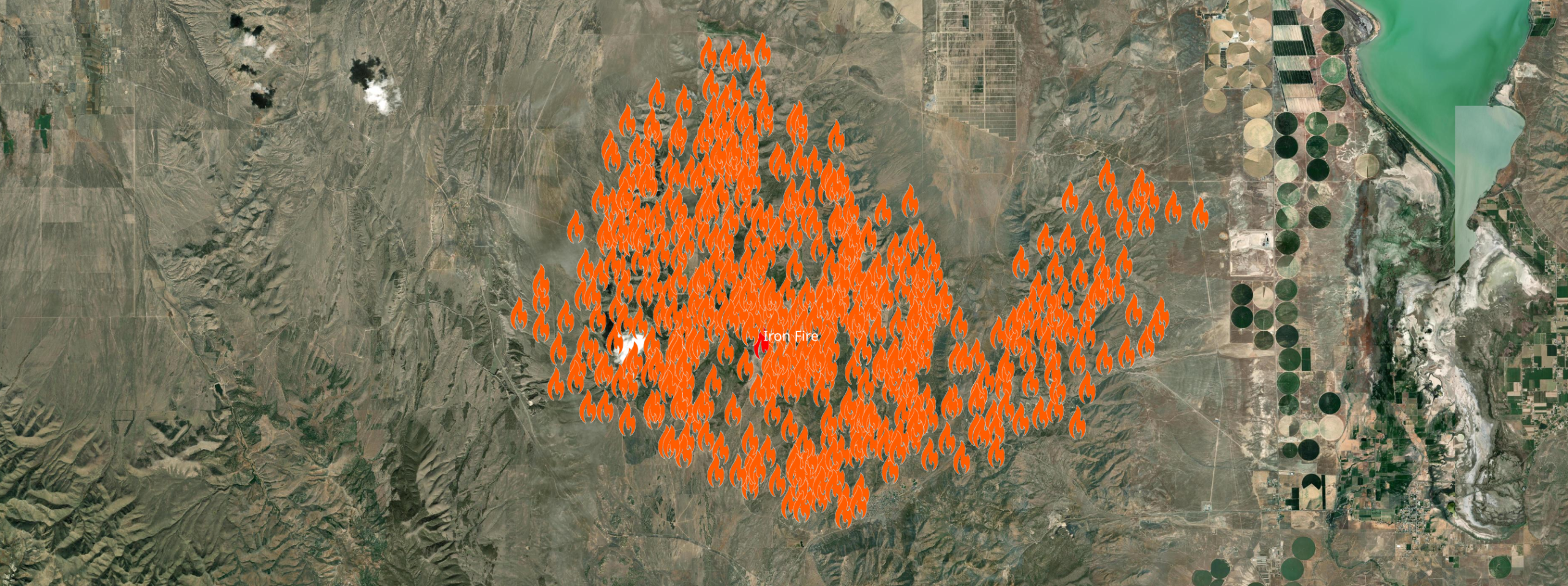
Locations of biomass burned by the Iron Fire in Utah (June, 2026)
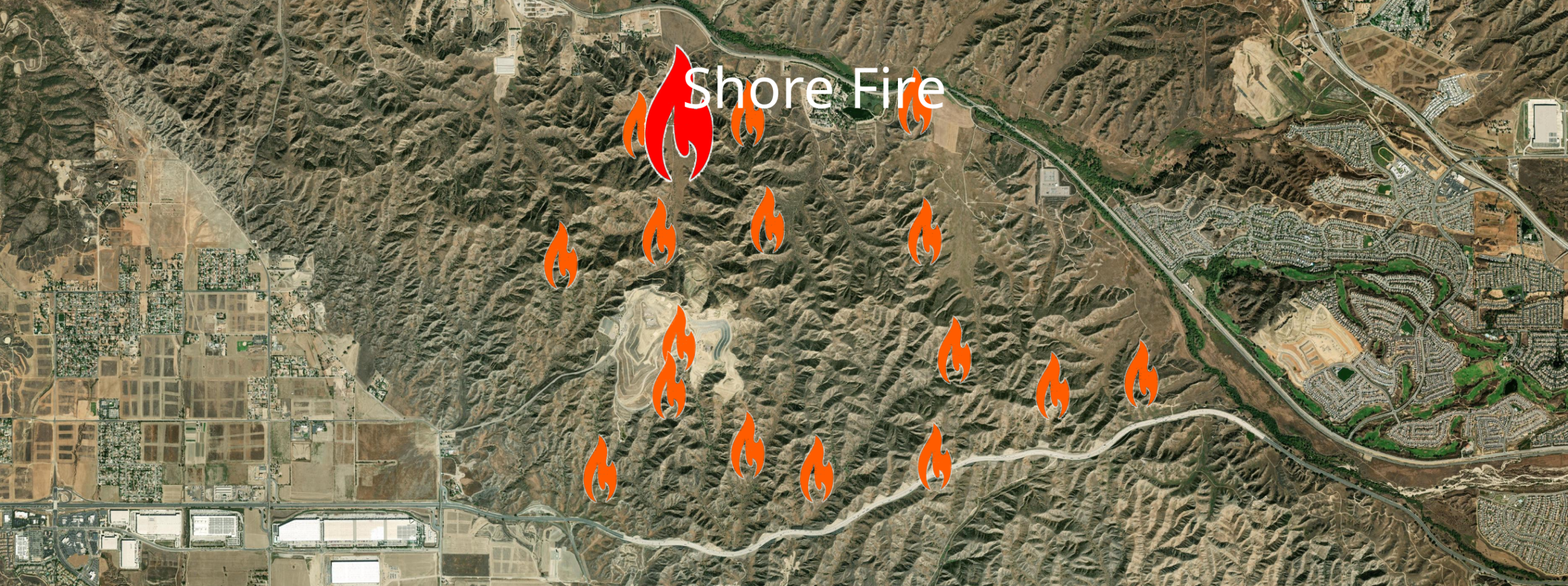
Locations of biomass burned by the Shore Fire in California (June, 2026)
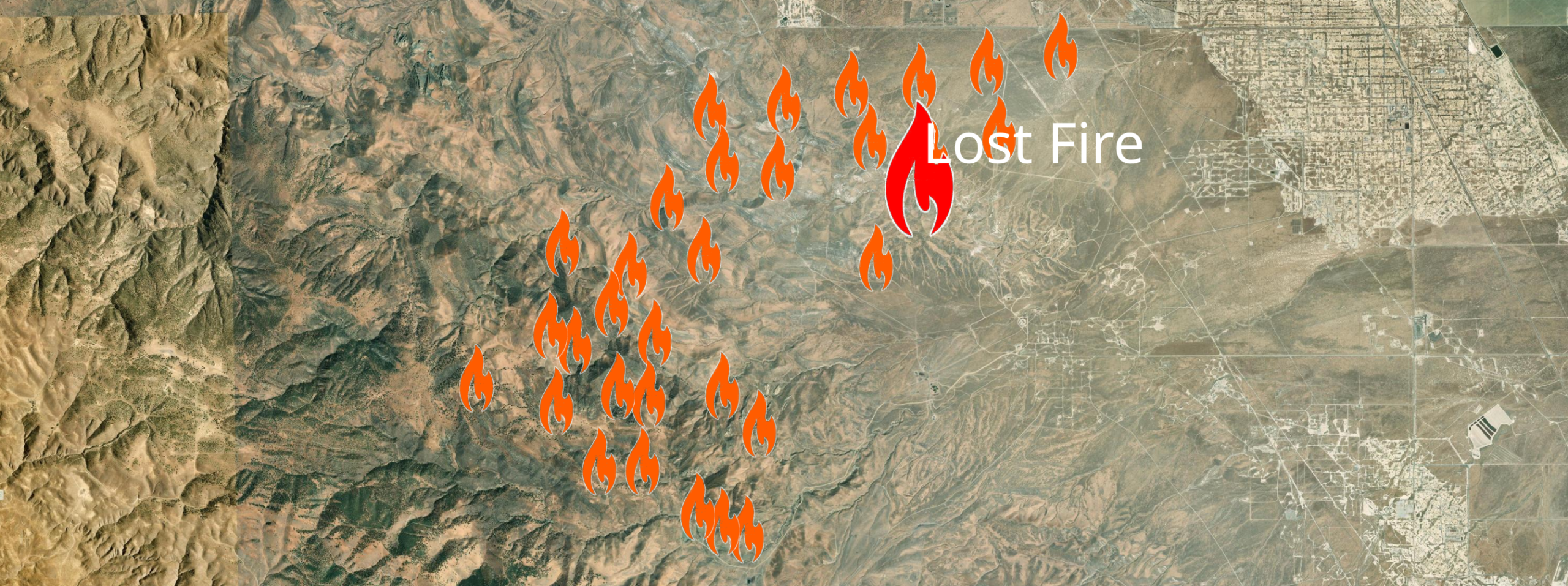
Locations of biomass burned by the Lost Fire in California (June, 2026)

4D wildfires and their impact on air composition

Wildfires generate very large amounts of greenhouse gases and air pollutants altering air composition with the largest ones having an impact even thousands of kilometers from the fire location and lasting several days. In order to capture their 3D spatial and temporal dynamics, our wildfire simulations integrate a combination of data satellite data with physical & combustion models into the solution of the transport equations governing  these complex phenomena. 

Wildfire impact reports

  • Numerical study of meteorological conditions and air quality during the January 2025 Southern California wildfires (download white paper: Eaton_Palisades_v1_1)
  • Numerical assessment of atmospheric and air quality conditions caused by the 2026 Utah and Colorado megafires

Impact of fireworks on air quality

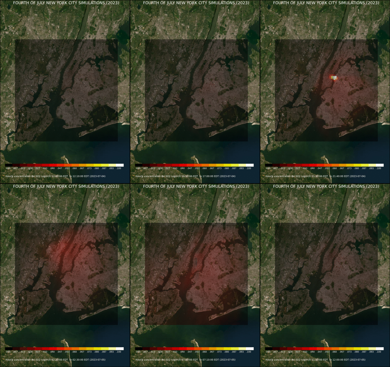
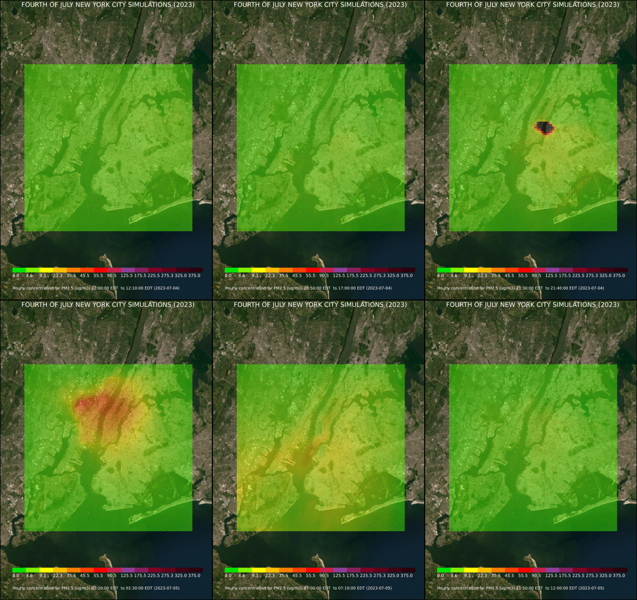
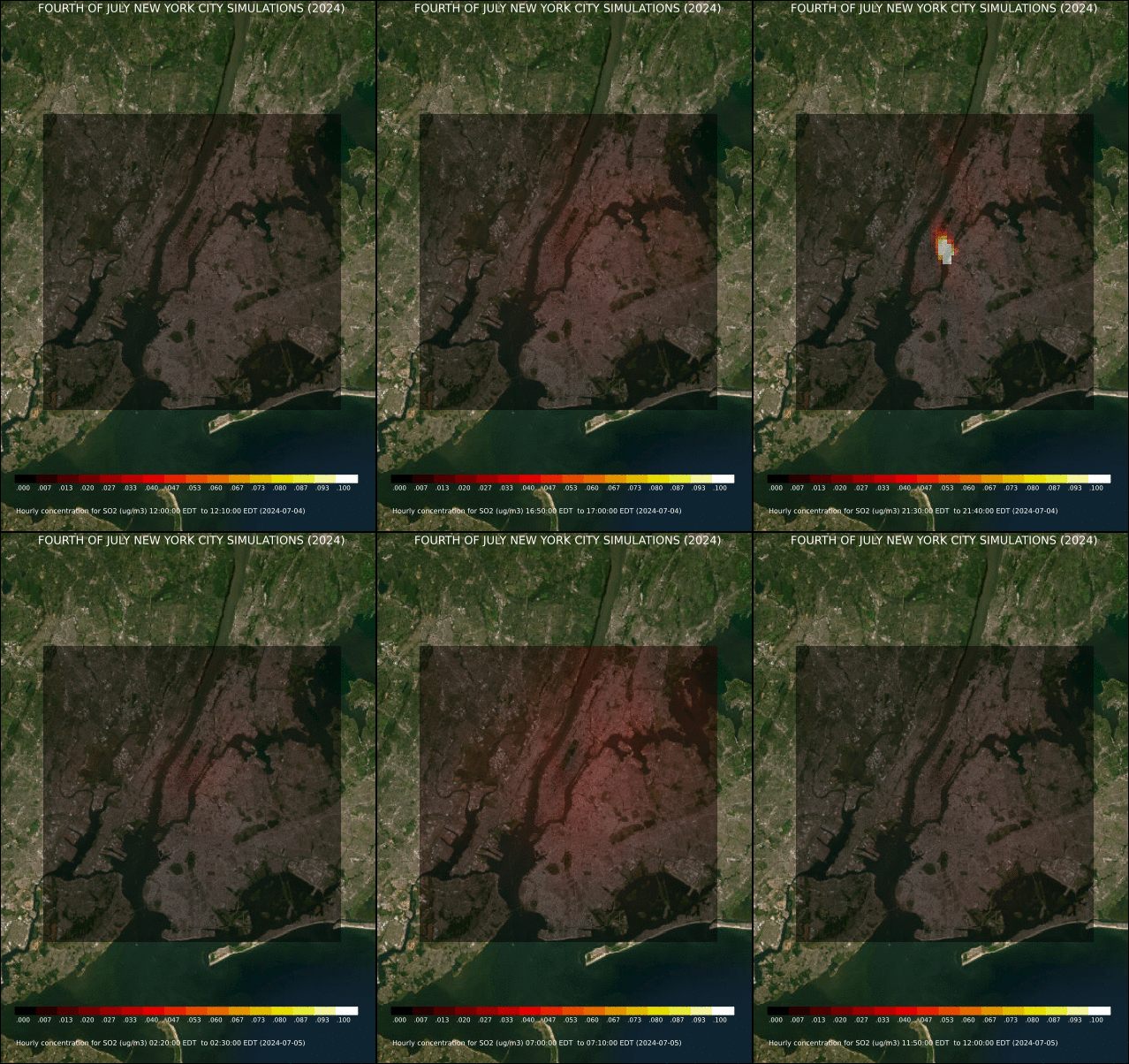
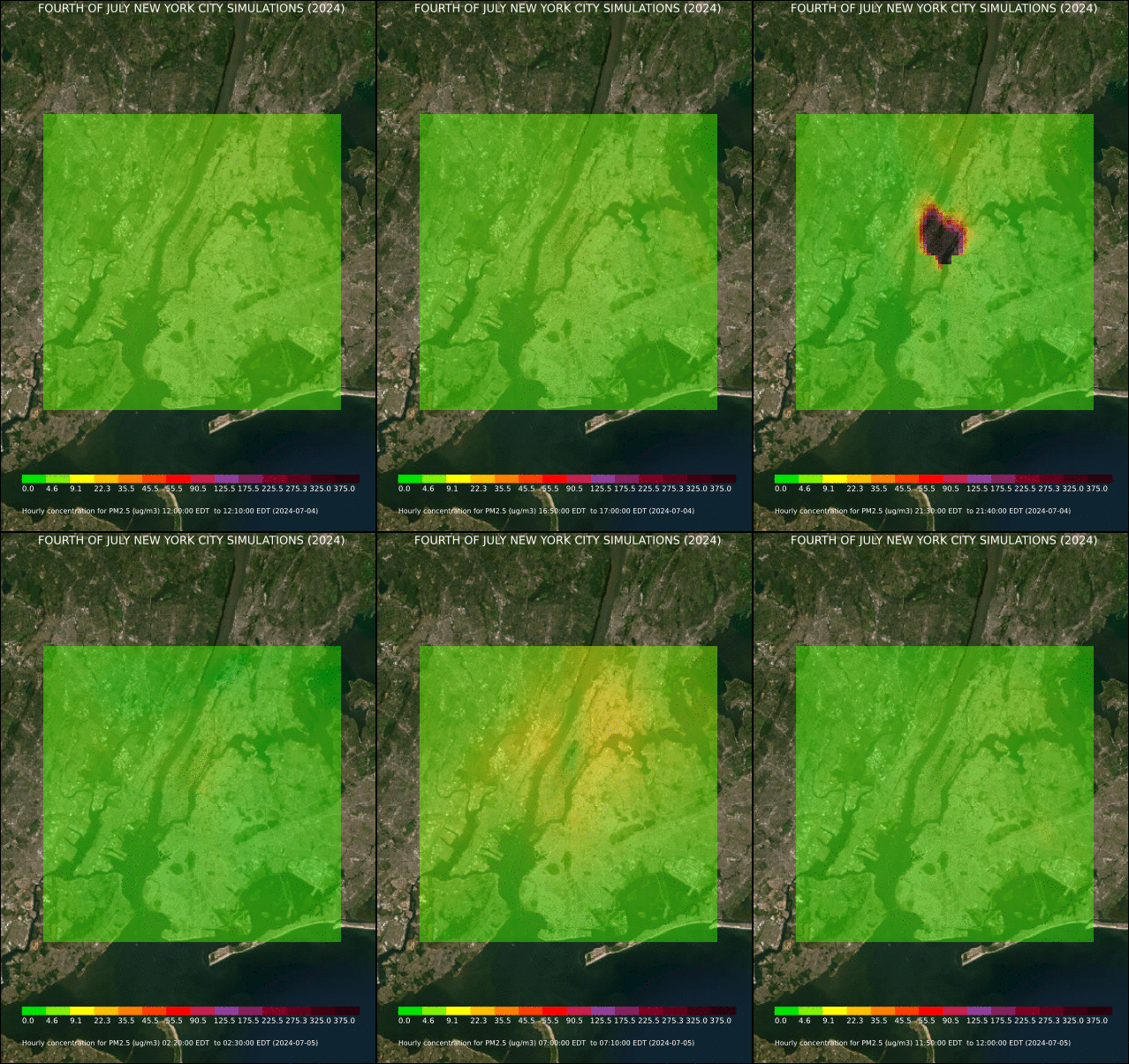
Display fireworks can significantly alter local air quality for several hours as chemical reactions generate significant quantities of particulate matter and other pollutants such as sulfur dioxide or nitrogen oxides. We are performing computations to assess the impact of meteorological conditions on the spatial-temporal concentration of these species in major metropolitan areas for large events such as U.S. 4th of July celebrations.